

In a groundbreaking step for environmental conservation, the Society for the Protection of Nature in Lebanon (SPNL) has unveiled the country’s first comprehensive map detailing bird species distribution within Lebanon’s Key Biodiversity Areas (KBAs). Developed in collaboration with GIS and remote sensing expert Bilal Alaouiyeh, this 2025 achievement is the first of its kind in the Middle East, setting a new standard for integrating biodiversity data with advanced spatial analysis.
A Unique Natural Crossroads
Lebanon’s position along the eastern Mediterranean, combined with its mountainous terrain and mild climate, makes it a critical stopover for migratory birds traveling along global flyways. These diverse landscapes host a rich variety of resident and migratory species, reinforcing the nation’s role as a biodiversity hub for the region.
From Static Tables to Dynamic Mapping
Previously, SPNL’s KBA bird data existed in static tables, lacking spatial integration. Through this initiative, the information has been transformed into a dynamic geospatial database. The project identified bird congregation sites within each KBA, linked them to SPNL’s Hima community-managed reserves, and quantified key metrics:
-
671 towns located within KBAs, home to an estimated 1,207,000 residents.
-
3,561 km² of total KBA land area across 19 officially recognized zones.
-
Detailed mapping of bird species locations, complete with site names and scientific classifications.
Notable Findings
The Rihane–Chouf–Aammiq–Sannine KBA emerged as the richest bird habitat, with 56 recorded sites. The map also for the first time links Lebanon’s river systems to KBAs, opening opportunities to integrate water resource management with biodiversity conservation.
[pdf-embedder url=”https://www.spnl.org/wp-content/uploads/2025/08/Avian-Biodiversity-and-Protected-Areas-in-Lebanon.pdf” title=”Avian Biodiversity and Protected Areas in Lebanon”]
Regional and Global Value
This is the only map in the Middle East developed with such a holistic methodology, merging GIS, remote sensing, and ornithological data. It offers a vital reference for:
-
Conservation organizations.
-
Urban and environmental planners.
-
Research institutions and academic bodies.
-
International bird protection networks.
About the Expert Behind the Map
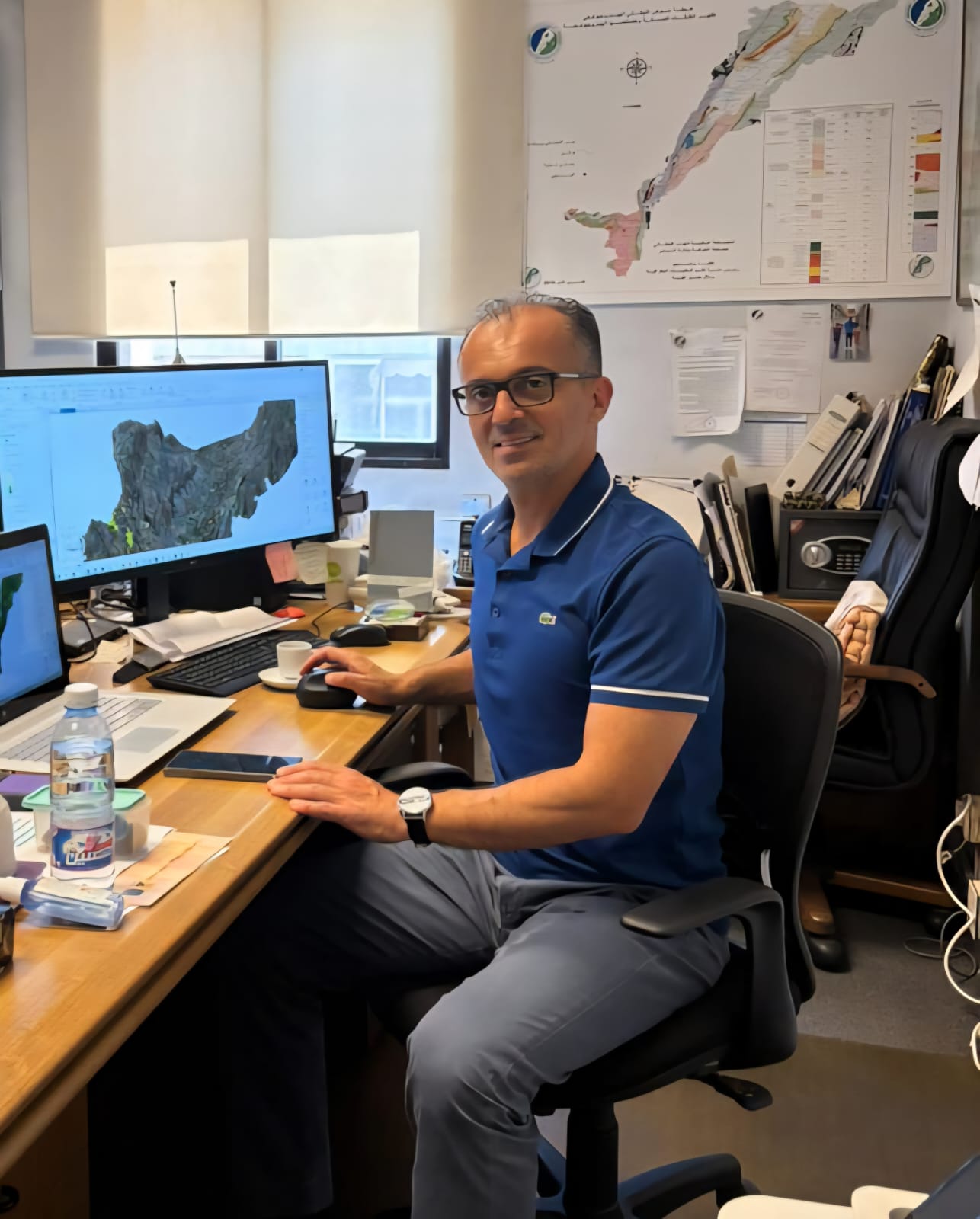
Bilal Alaouiyeh, with over two decades of experience in environmental, urban development, and disaster risk management projects, has played a key role in pioneering spatial analysis for biodiversity in Lebanon. His work integrates cutting-edge geospatial tools to support evidence-based decision-making in conservation and resilience planning.
A Strategic Tool for the Future
By bridging science and spatial intelligence, SPNL has provided Lebanon—and the global conservation community—with a powerful platform to track, plan, and protect avian biodiversity. This initiative not only strengthens Lebanon’s environmental leadership but also paves the way for regional replication, ensuring that the country’s skies remain a sanctuary for birds for generations to come.

")
")