
As part of efforts to strengthen environmental cooperation, a team from the Litani River Authority held a coordination meeting with a delegation from the Society for the Protection of Nature in Lebanon (SPNL). The two parties agreed on a series of joint projects and initiatives aimed at reducing pollution in the Litani River and enhancing the protection of biodiversity in its surrounding areas.

The discussions focused on mechanisms to curb industrial pollution, particularly wastewater discharge from dairy factories in the Upper Litani Basin. Both sides emphasized the importance of strengthening environmental oversight and promoting greater compliance among industrial facilities.

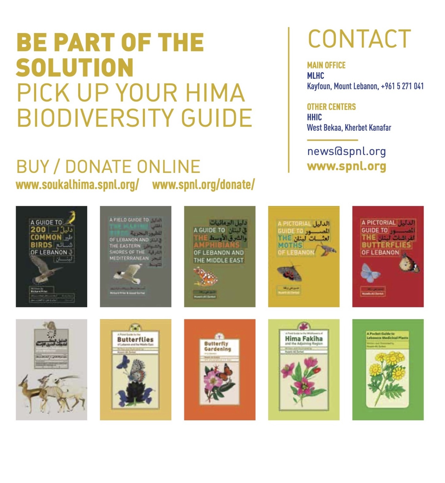
The meeting also resulted in an agreement to collaborate on the establishment of a Hima (community-based protected area) in the towns of Saghbine and Kherbet Qanafar near Qaraoun Lake. This initiative aims to restore ecological balance, safeguard natural habitats, and support local communities in conserving natural resources.
In a spirit of scientific transparency and collaborative monitoring, the Litani River Authority agreed to grant SPNL access to its laboratories for environmental sample analysis. This will enable the harmonization of monitoring methodologies and facilitate integrated environmental data collection.
The Litani River Authority reaffirms its commitment to expanding environmental partnerships with local and international stakeholders in pursuit of sustainable development goals and the protection of the Litani River and Qaraoun Lake.
🗺️ Map of the Litani River Basin and the Municipalities Within It – Total: 288 Municipalities (Upper Basin: 157 / Lower Basin: 131)

Definition of the Litani Basin (Basin Geography):
The total area of the Litani River Basin is estimated at 2,112 km², which accounts for about 20% of Lebanon’s territory.
The basin includes 288 municipalities spread across various Lebanese regions.
The Litani River Basin is divided into two main sub-basins:
-
The Upper Basin, which extends from the river’s source in Ain Arghash in West Bekaa to Qaraoun Lake, covering an area of 1,483 km².
-
The Lower Basin, which extends from the Qaraoun Dam outlet to the river’s mouth in Qasmiyeh/Zahrani, covering an area of 629 km².
The basin, from source to mouth, exhibits a diverse range of ecological, geographic, and demographic features.
-
The Upper Basin contains 157 municipalities.
-
The Lower Basin contains 131 municipalities.
Geographic Features:
-
The Litani River is the longest river in Lebanon, with a length of approximately 170 km.
-
The Upper Basin includes the largest number of municipalities and spans both the Western and Eastern Lebanon Mountain ranges.
-
The basin stretches across a range of administrative regions.
Number of Municipalities in Each District Within the Litani Basin:
-
Zahle: 62 municipalities
-
Baalbek: 45 municipalities
-
West Bekaa: 41 municipalities
-
Marjeyoun: 28 municipalities
-
Tyre: 21 municipalities
-
Bint Jbeil: 20 municipalities
- Jezzine: 20 municipalities
-
Nabatieh: 13 municipalities
-
Rachiya: 11 municipality
-
Sidon: 9 municipalities
- Chouf: 7 municipality
- Hassbiya: 5 municipalities
- Baabda: 3 municipalities
-
Aley: 2 municipalities
- Maten: 1 municipality
📅 Date: Sunday, May 29, 2022
Prepared by:
Litani River Authority (LRA)
BILAL HASSAN ALAOUIEH


